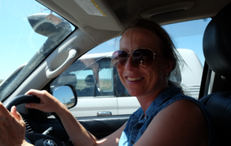
Katherine Thomas
Katherine Thomas |
||||||||
|---|---|---|---|---|---|---|---|---|
Birth Place: |
USA |
|||||||
Occupation: |
Archaeologist |
|||||||
Professional Membership: |
{{{member}}}
|
|||||||
Known For: |
Archaeology,GIS |
|||||||
Education: |
La Trobe University, University of Southampton, University of Durham |
|||||||
Doctoral Advisor: |
Dr Nicola Stern,Dr Mal Ridges,Dr Matt Meredith-Williams |
|||||||
Email: |
{{{email}}}
|
|||||||
ORCID: |
{{{orcid}}}
|
|||||||
|
||||||||
|
|
||||||||
Katherine Thomas is currently finishing her PhD and works as GIS Specialist/Research Assistant alongside her research.
Introduction
Katherine Thomas has spent the last two decades building a portfolio of academic and commercial work within Australian and British archaeology. This includes substantial contributions to several published reports by surveying, creating GIS geodatabases, and analyzing the data sets. Katherine has written and delivered two courses on applied cultural heritage management and GIS at core undergraduate level for La Trobe and at adult education level for the Centre for Community Engagement, University of Sussex, UK. In addition, Katherine has worked on biodiversity action plans, flora and fauna database design, and worked internationally as a field archaeologist on surveying/excavation projects.
Current Research
PhD: Human-environment interaction, traces, and movement within the Willandra Lakes Region World Heritage Area
Mungo is best-known for its archaeological traces dating to the time period between c.45-15 ka. However, people continued to inhabit this region until the pastoral frontier was established. This project was designed to reconstruct and retrodict the cultural landscape of the Willandra Lakes Region World Heritage Area (WLRWHA) at the time of European settlement with the aim of characterising a complex cultural landscape. The project draws on methodologies derived from archaeology and cultural geography to develop a model of cultural landscape as a spatial narrative within a GIS.

